Open Noland Trail is a free, open resource of geographic data
at the Mariners Museum Park & Noland Trail
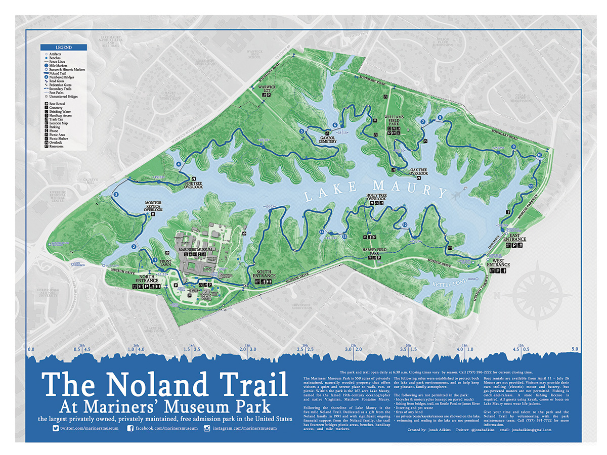
The Mariners' Museum Park is 550 acres of privately maintained, naturally wooded property that offers visitors a quiet and serene place to walk, run, or picnic. Within the park is the 167 acre Lake Maury, named for the famed 19th century oceanographer and native Virginia, Matthew Fontaine Maury. Following the shoreline of Lake Maury is the five mile Noland Trail. Dedicated as a gift from the Noland family in 1991 and with significant ongoing financial support from the Noland family. The trail has fourteen bridges, picnic areas, benches, handicap access, and mile markers.
The Mariners' Museum Park is open daily to the public. Benches at approximately every half-mile offer places of rest along the trail, and views of Lake Maury can be found around every corner.
Visit Their Website