Back to the land of free wi-fi! Our Disney cruise was absolutely a blast, and the per-megabyte charge for internet kept relaxation at a maximum :) . Continuing on the theme of great cartography at Disney, here are some pics from the Pangani Forest Exploration Trail at Disney’s Animal Kindgom park.
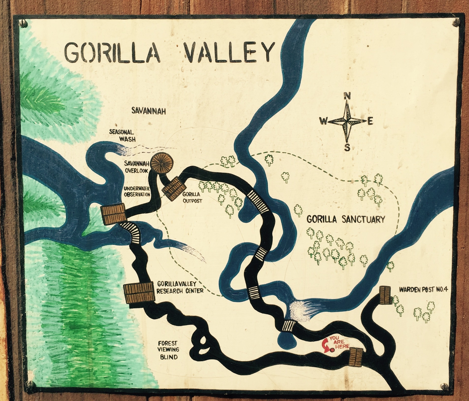
Gorilla Valley - an overview of the trail using a neat marker drawn style.
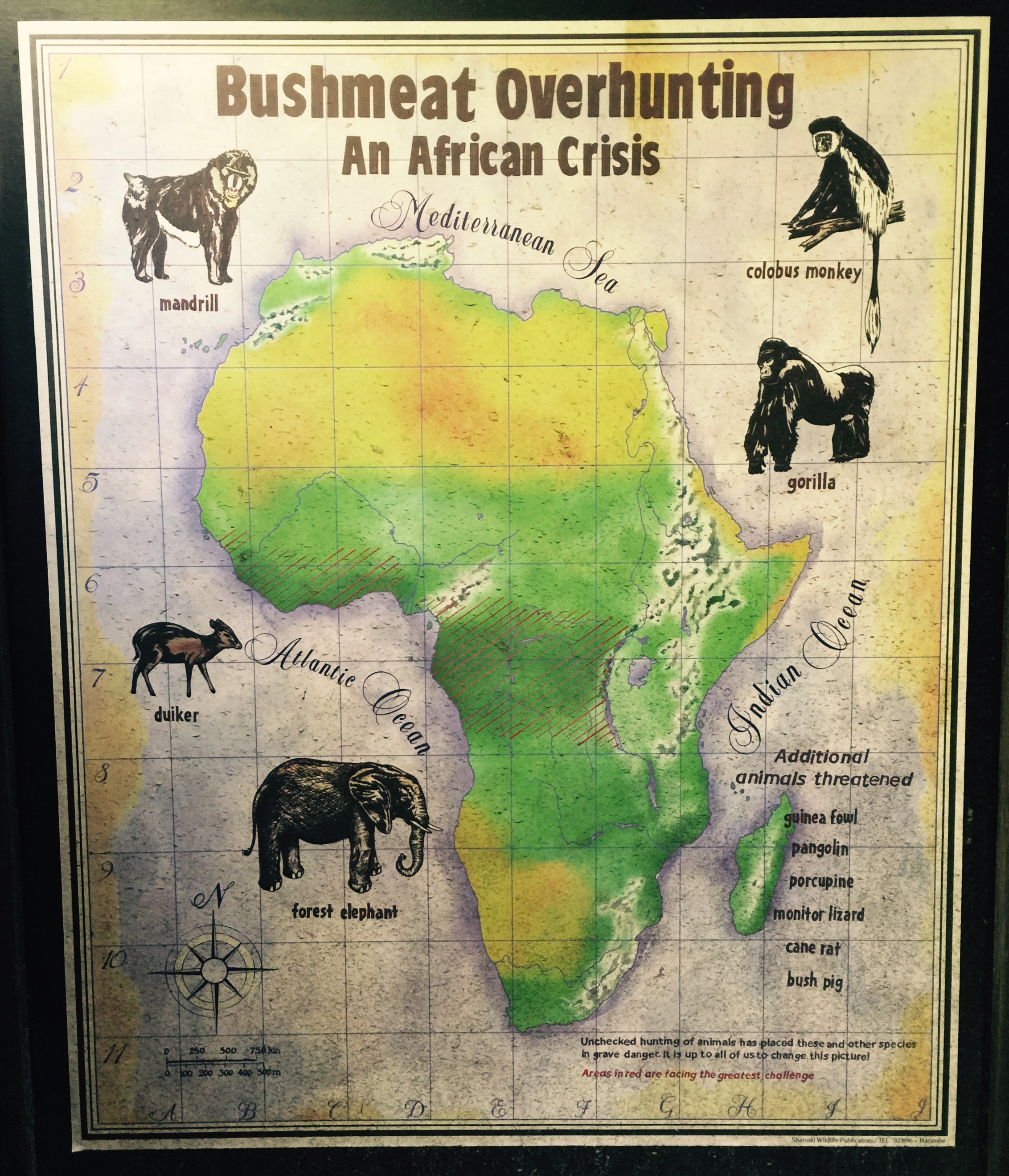
Bushmeat Overhunting: An African Crisis - woah! a GIS style map of overhunting areas. Nice fonts for the ocean names, with a random letter-number index overlaid on the whole thing.
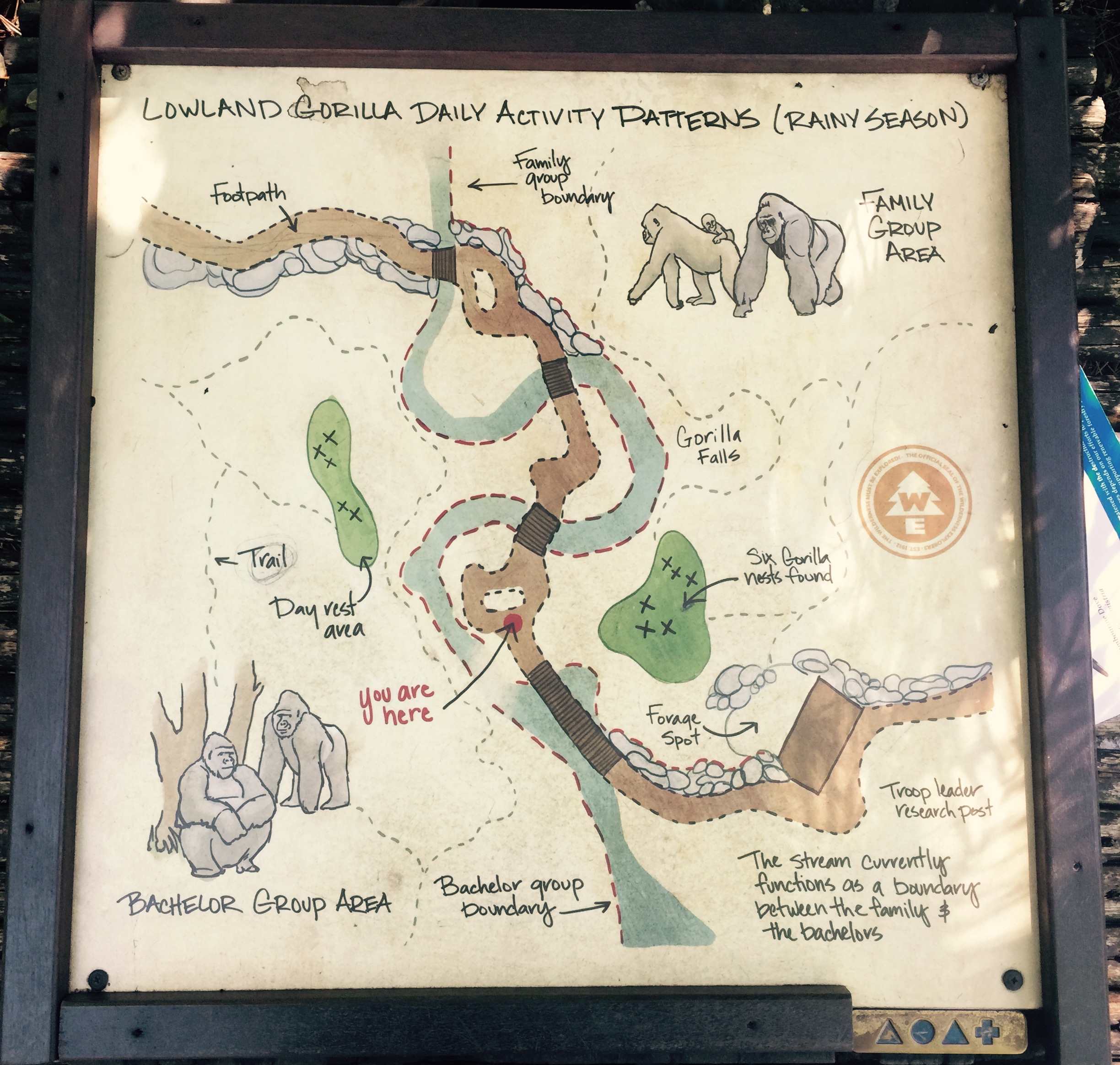
Lowland Gorilla Activity Patterns - a hand drawn inset to the “Gorilla Valley” map above. The areas of rock feature some nice symbology and the highlight has to be the illustrative Gorillas.