I’ve been practicing some self-taught cartography lately, focusing on colors and simplicity of visualizing data. There’s been quite a bit of open data to explore with recent releases here in Virginia through the State’s GIS org., VGIN and VDOT the State’s transportation org.
Using ArcGIS Pro and some of these datasets, I’ve created a series of (hopefully) easy to understand maps, using some non-default, non-standard, color combinations. There’s definitely nothing new or particularly awesome about the techniques used, but some of the patterns that emerge are pretty neat.
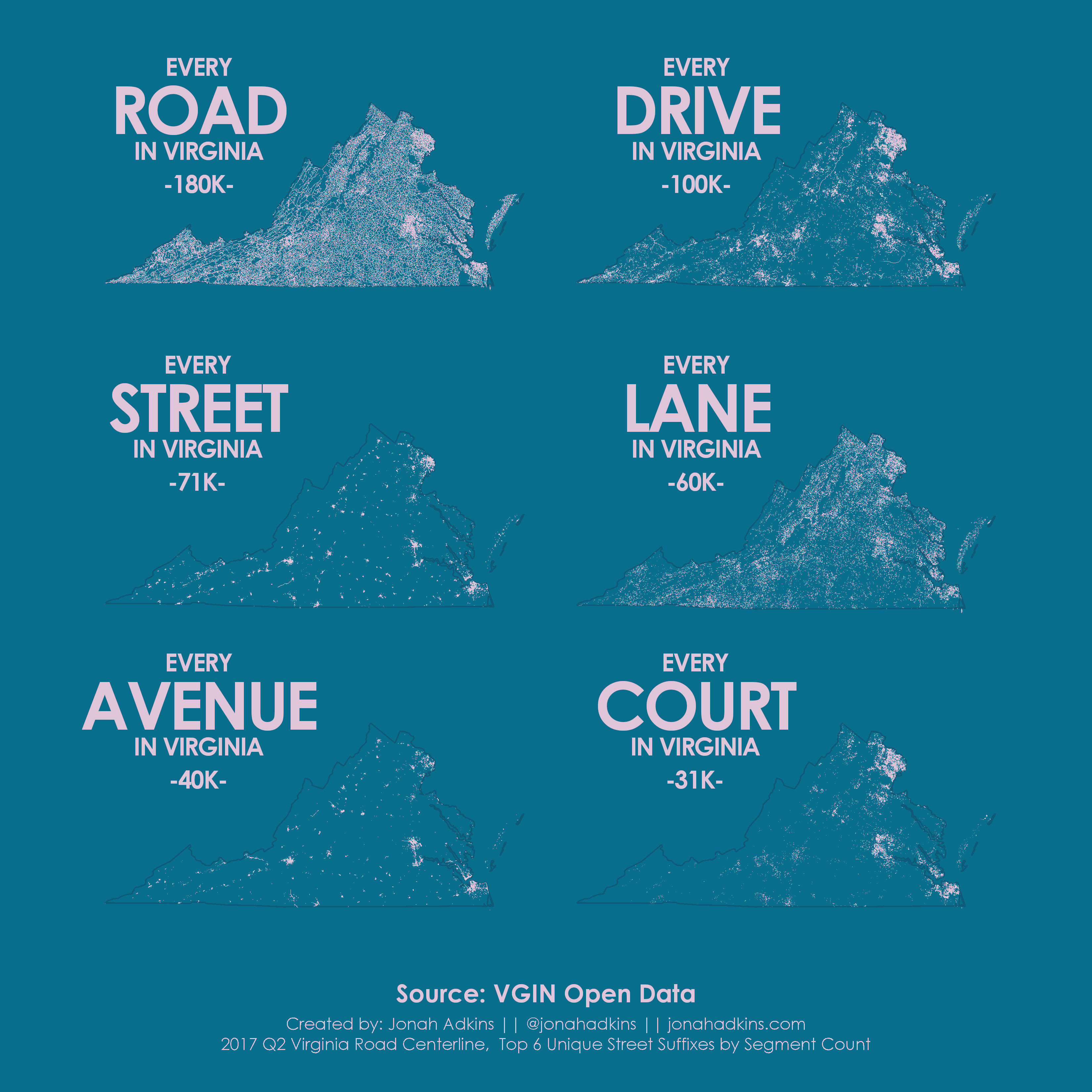
Every ___ In Virginia
Top 6 Road Suffix Types by Segment Count using the VGIN/VDOT State Road Centerline (RCL) file.
It appears “Road” is the most popular across the state, and “Court” is particularly dense in high-population residential areas.
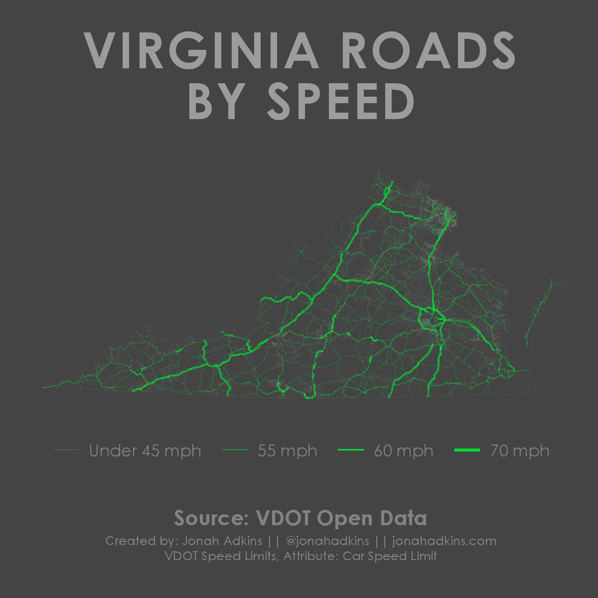
Virginia Roads by Speed
VDOT Speed Limit centerline file
Very simple visualization using overlapping transparencies and line thickness’s.
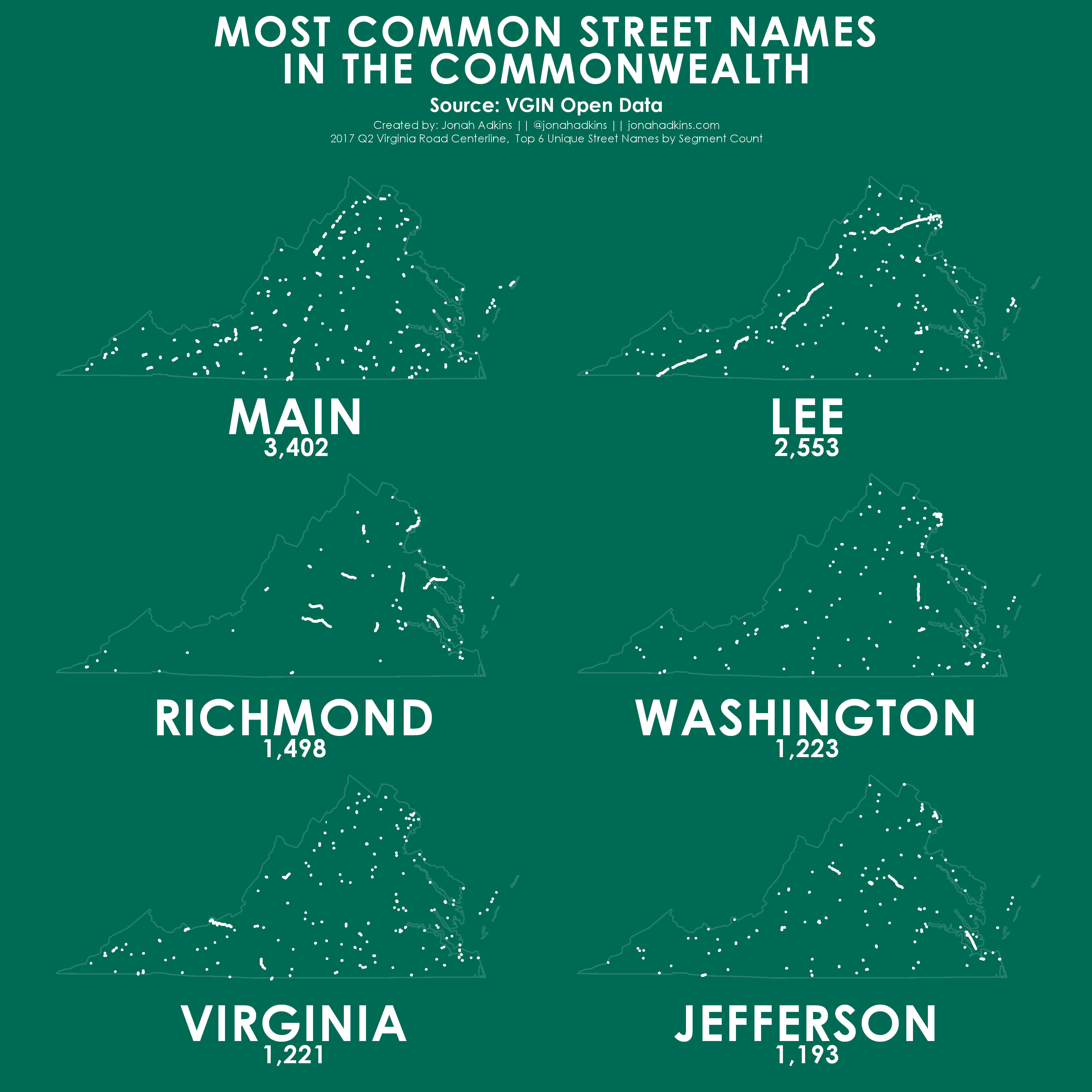
Most Common Street Names in the Commonwealth
Top 6 Street Names by Segment Count using the VGIN/VDOT State Road Centerline (RCL) file.
Virginia’s history shows pretty strong here and no surprise “Virginia” makes the top 6.
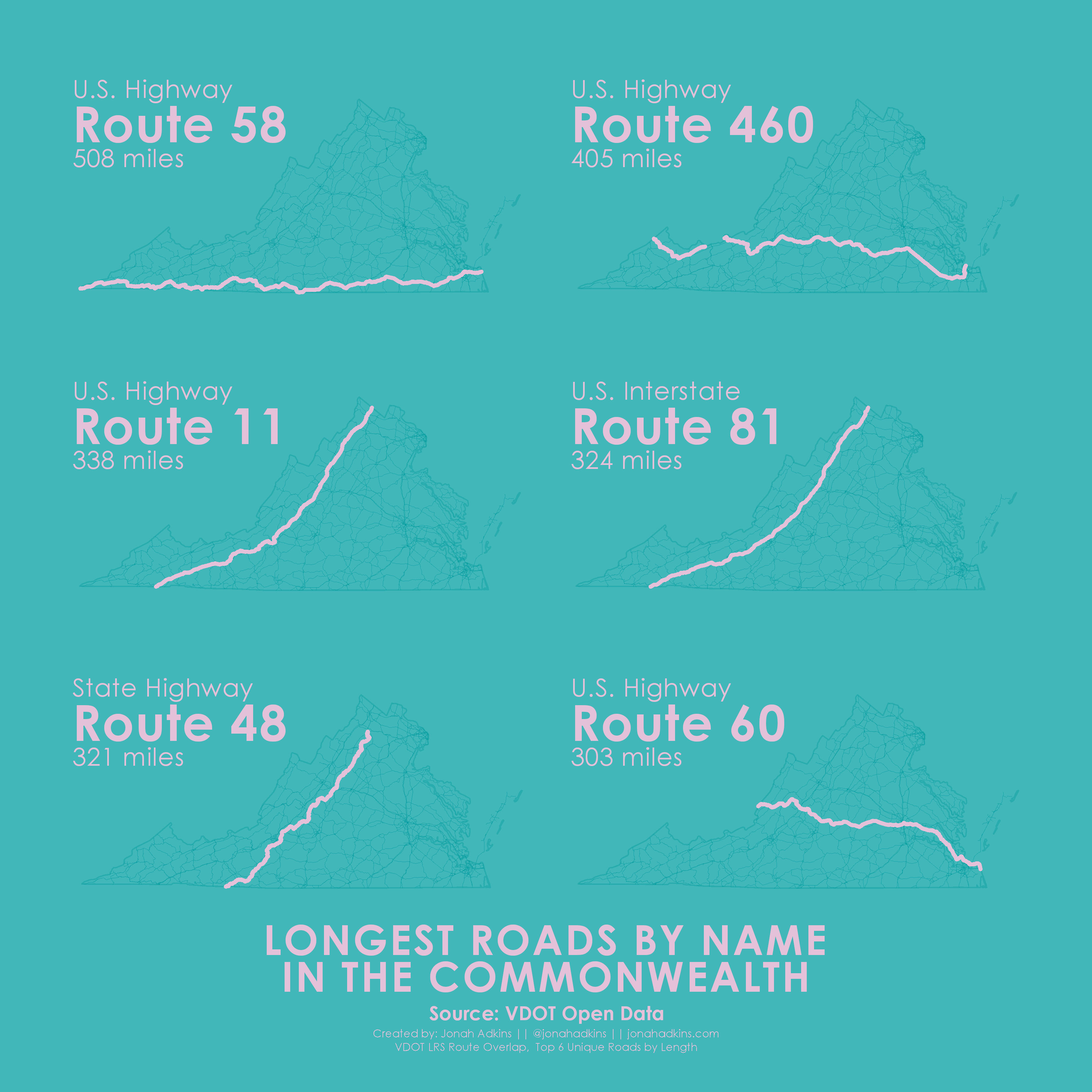
Longest Roads by Name in the Commonwealth
Top 6 Unique Roads by Length using the VDOT LRS Route Overlap file.
The LRS file from VDOT contains a single (1) record for every named road in the State, which is awesome in itself.
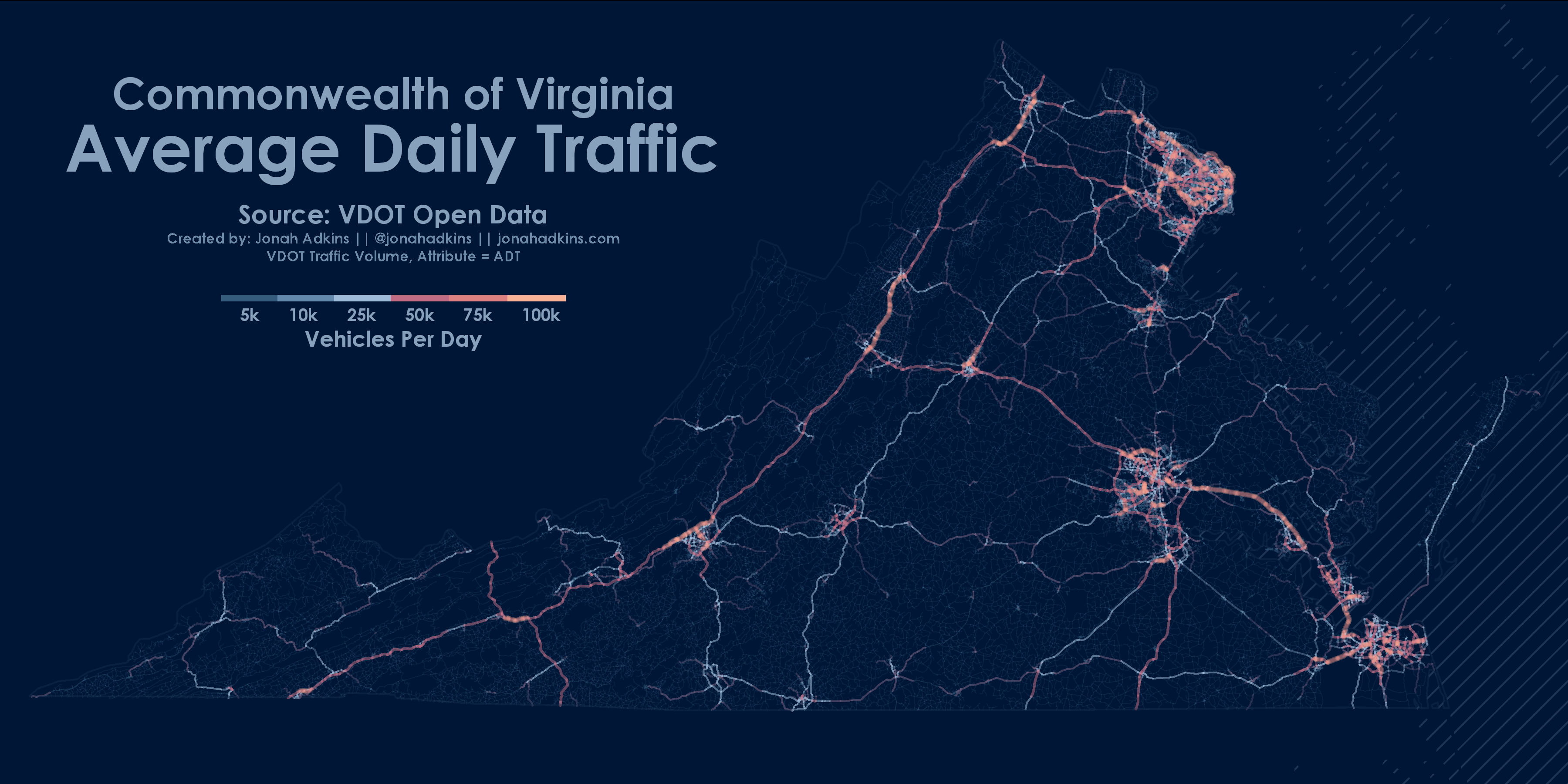
Average Daily Traffic
VDOT Traffic Volume Layer
Again, using overlapping transparencies and line thickness’s, this is more or less a population map but shows some nice patterns of non-interstate travel.
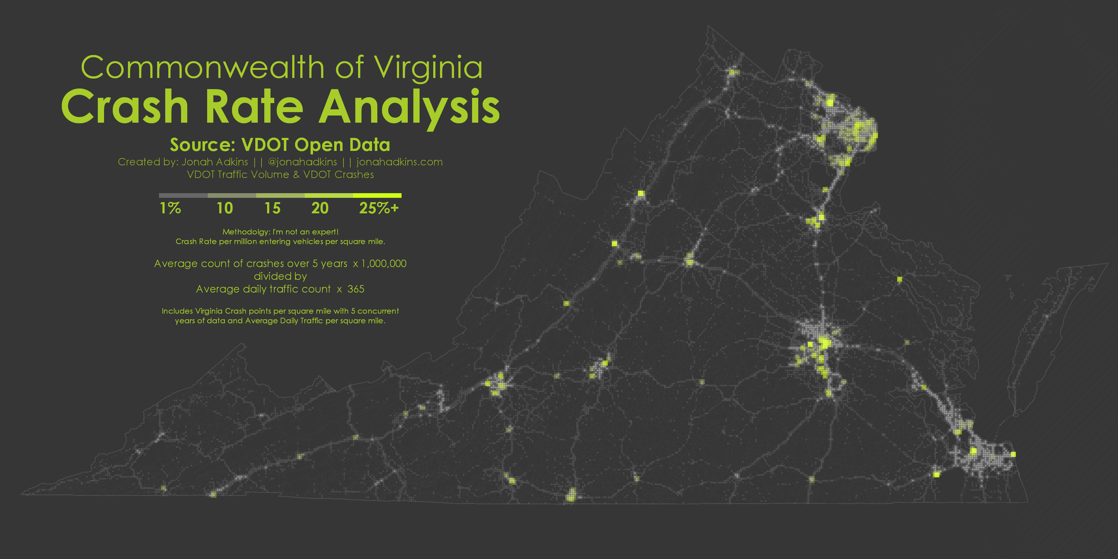
Crash Rate Analysis
VDOT Crashes file & VDOT Traffic Volume
For this non-expert analysis, I defined square mile bins summarizing data from both crash locations and volume of traffic to determine some rudimentary crash rate areas.
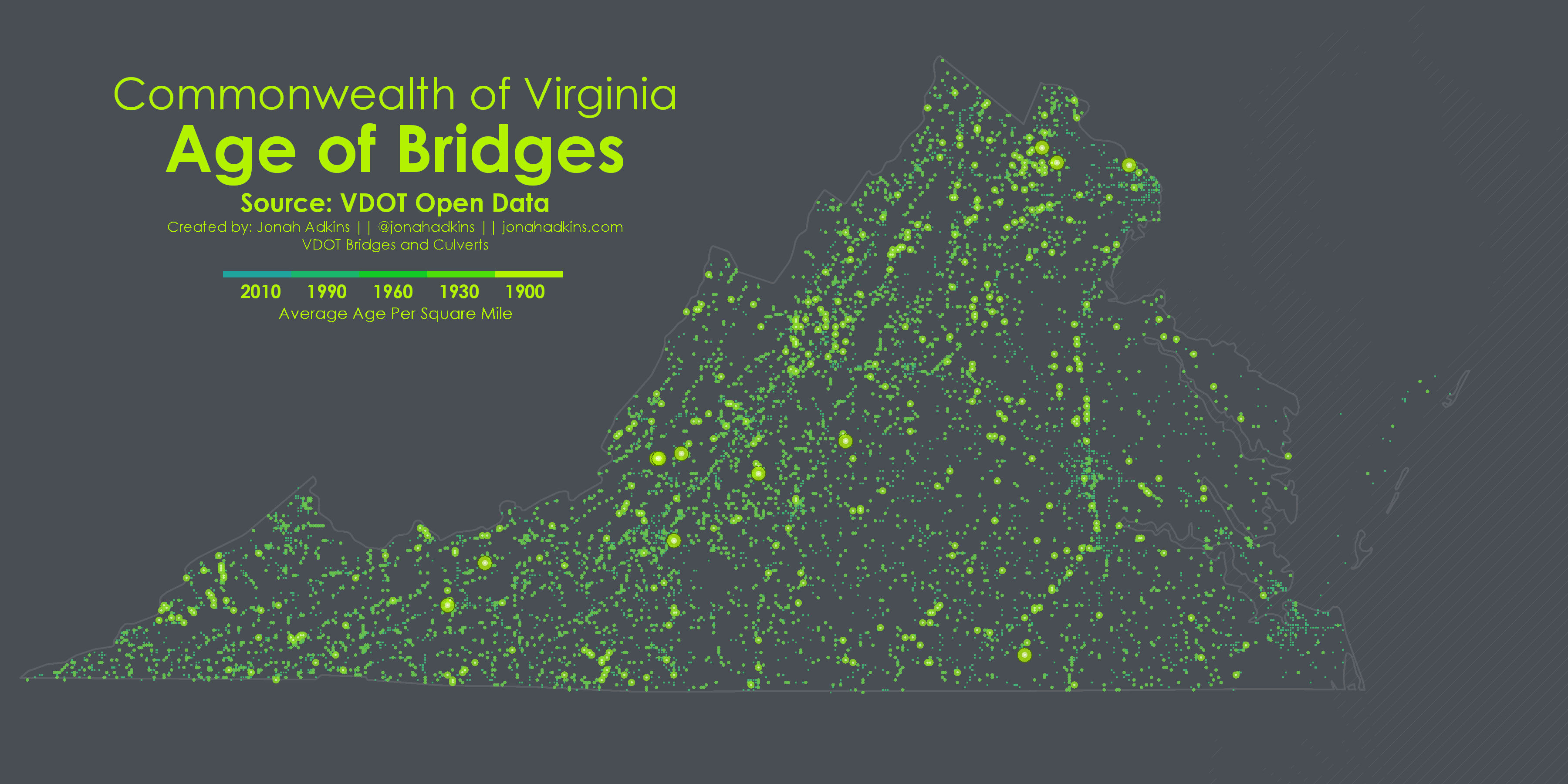
Age of Bridges
VDOT Bridges and Culverts file by Age.
Using a similar binning technique as above, this map shows the average age of bridges per square mile.
Please feel free to email me or hit me up on twitter if you want some more details, copies of my ArcGIS Pro docs, or have any general questions.
Much thanks to John and Gretchen for various carto-shoulder leaning while making these maps!