Happy 2018! Over the last few months I’ve put about 160 hours ( 😳😳😳 ) into the gorgeous Legend of Zelda:Breath of the Wild for Nintendo Switch. One of the more striking elements to this cartographer, of course, are the location maps that are the backbone of navigating through the game.
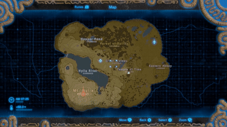

The animated map above shows the first unlocked map against a grid, while the second is the full game map. The map relies heavily on topographic display only using colors like green, red, and blue in small doses. Highlighted locations uses neon type symbology/text against the yellow to brown gradient.
Just for fun, I wanted to try out the unique map style on some familiar data. I pulled together some features from my Open Noland Trail data site and got to work. First and foremost was getting the topographic gradient right - mostly using a downloaded image with a color-picker tool.

Using the color scheme editor in ArcGIS Pro, I was able to assign color values consistent with the elevation values of my Noland Trail elevation dataset. And that was the hardest part.
The rest was mimicking the awesome design of the game map. I kept pretty close to the original design, but added some contextual elements specific to the trail. Probably spent about 3 hours all together, but it goes quick when you’re just having fun making a map.
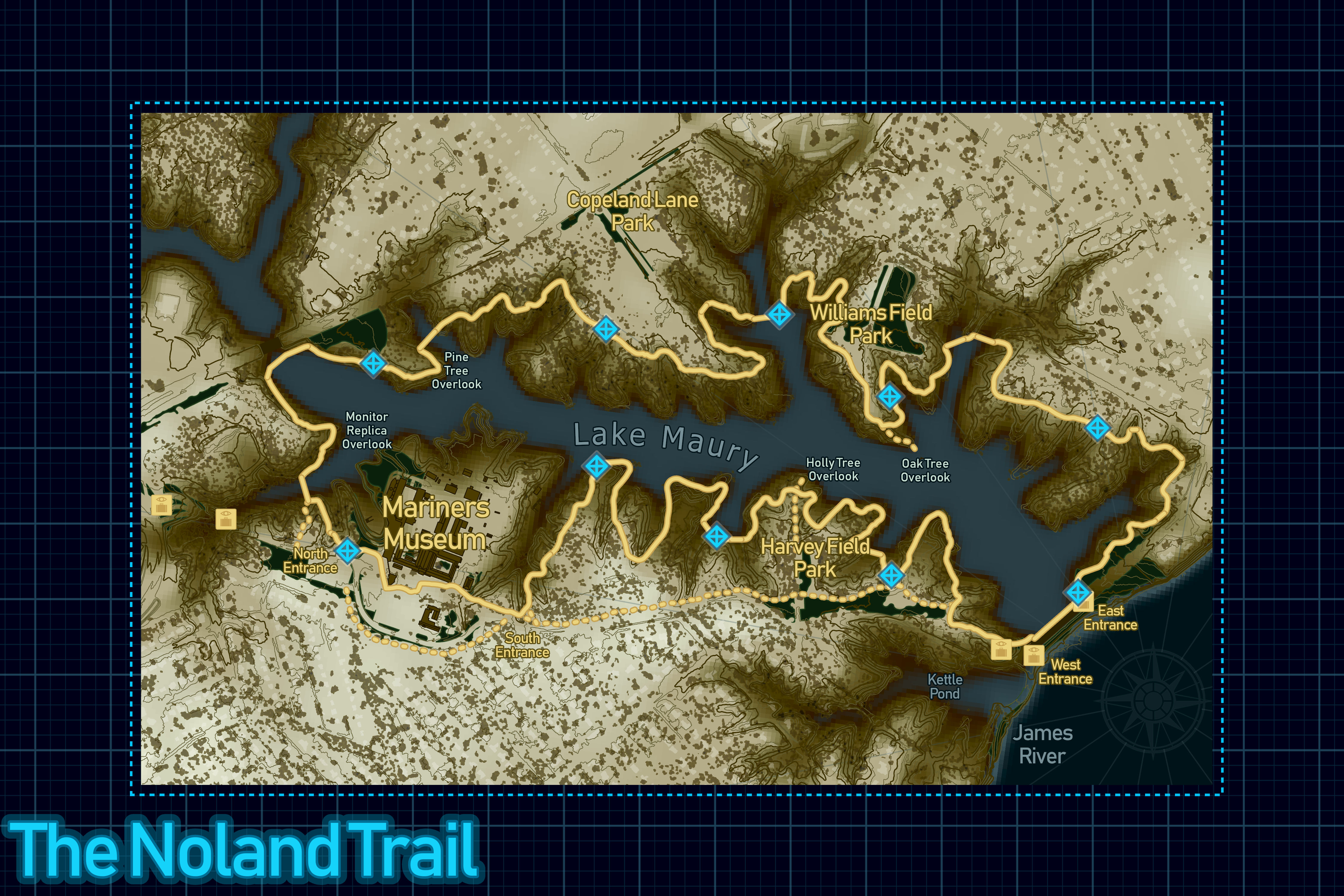
Please feel free to email me or hit me up on twitter if you want some more details, copies of my ArcGIS Pro docs, or have any general questions.